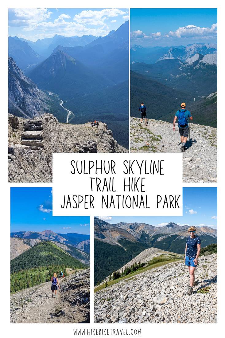
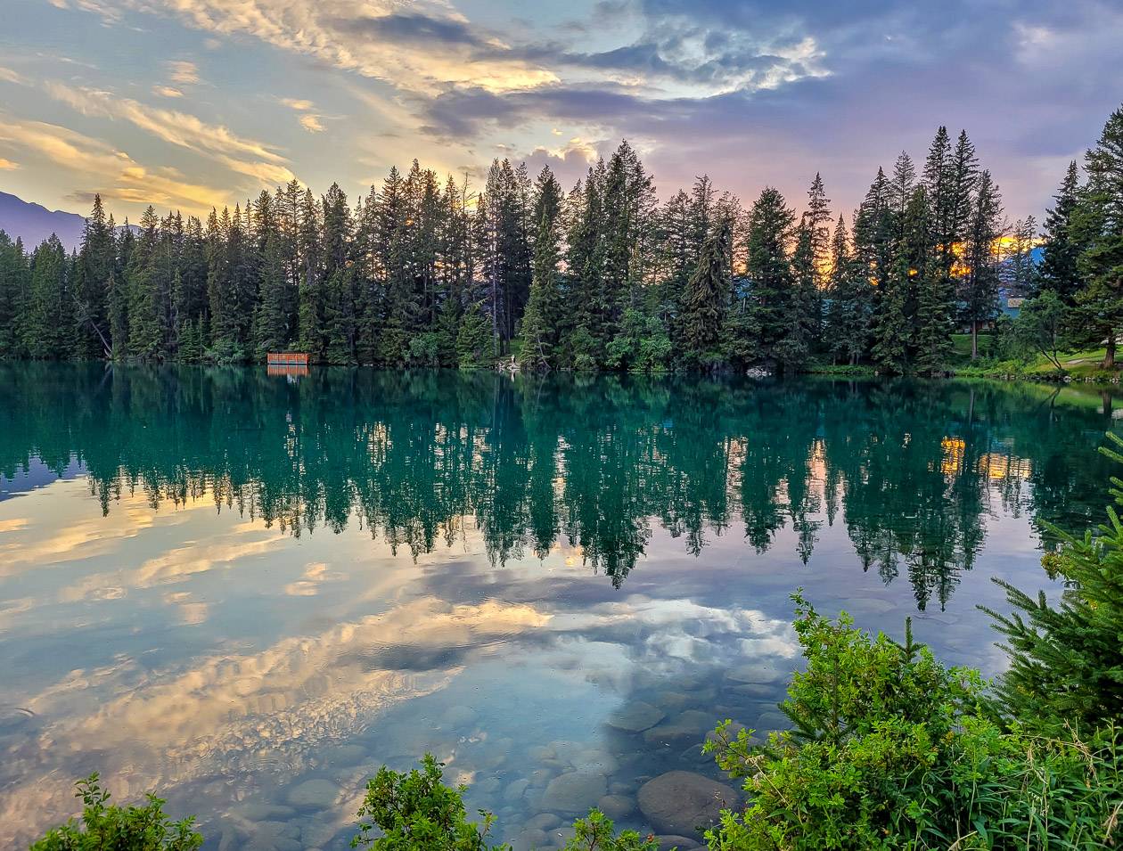
Sulphur Skyline Trail Hike, Jasper National Park

The Sulphur Skyline trail hike in Jasper National Park draws the crowds, even though it’s take-your-breath-away steep for a good part of it. But the popular hike is a rewarding one, offering up 360 ° degree views from the summit, especially of the Fiddle River, Utopia Mountain, and Ashlar Ridge. It’s one of the view hikes in the Canadian Rockies where you can combine a strenuous hike with a soak in a hot springs – with the other hike being the Sulphur Mountain hike in Banff National Park. The hike starts within spitting distance of the Miette Hot Springs, so while you’re working hard on the hike, you can dream about the soothing waters you can enjoy after.
This post includes some affiliate links. If you make a qualifying purchase through one of these links, I will receive a small percentage of the sale at no extra cost to you. Thank you very much for your support.
Sulphur Skyline Trail hike summary
- You will need a national park pass to do the hike.
- The hike is 8.0 km return with an elevation gain of 700 metres.
- It will take most people somewhere between 3 – 4 hours to hike it.
- I’d rate the trail as moderate but if you’re not a regular hiker or you’re not in great shape you might find it difficult. There are no technical sections on the hike.
- The road to the trailhead and Miette Hot Springs is closed seasonally from November until April.
- The trailhead (and Miette Hot Springs) is 61 km east of the Jasper townsite and 51 km west of Hinton.
- Check weather forecasts before you go as the summit is very exposed and wouldn’t be a good place to be in an electrical storm.
- Dogs are permitted on a leash. Be sure to pick up after them.
- Pack the hiking essentials including plenty of water as you won’t find any on the trail. Don’t forget water for the dog too.
- At the end of the hike, you can soak in the hot springs and buy refreshments at Miette Hot Springs Bungalows.
Sulphur Skyline trailhead location
If you can find Miette Hot Springs, then you’ll have no trouble finding the Sulphur Skyline trail. It starts at the southeast end of the Miette Hot Springs parking lot. You’ll find trail signs and you’ll see a paved trail leaving the area. That’s the trail. From Jasper it’s a 61 km drive via the Yellowhead Highway and Miette Hot Springs Road. Budget an hour of driving time each way. From Hinton, it’s about a 50-minute drive.
Location map
Sulphur Skyline trail hike information
Distance: 8.0 km round trip
Elevation gain: 700 metres or 2,297 feet
Maximum elevation: 2070 metres (6,790 feet)
Difficulty: Moderate
Time needed: 3 – 4 hours
Location: Starts southeast of the Miette Hot Springs parking lot
Dogs allowed: Yes, on a leash
Map needed: Gem Trek Jasper & Maligne Lake
Don’t forget: A bathing suit and towel for a post hike soak
Before you go: Check the weather forecast as the summit is exposed.
More reading on Jasper area hiking
Sulphur Skyline Trail route description
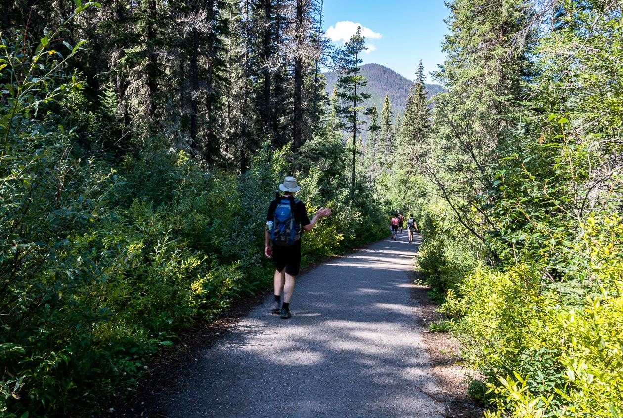
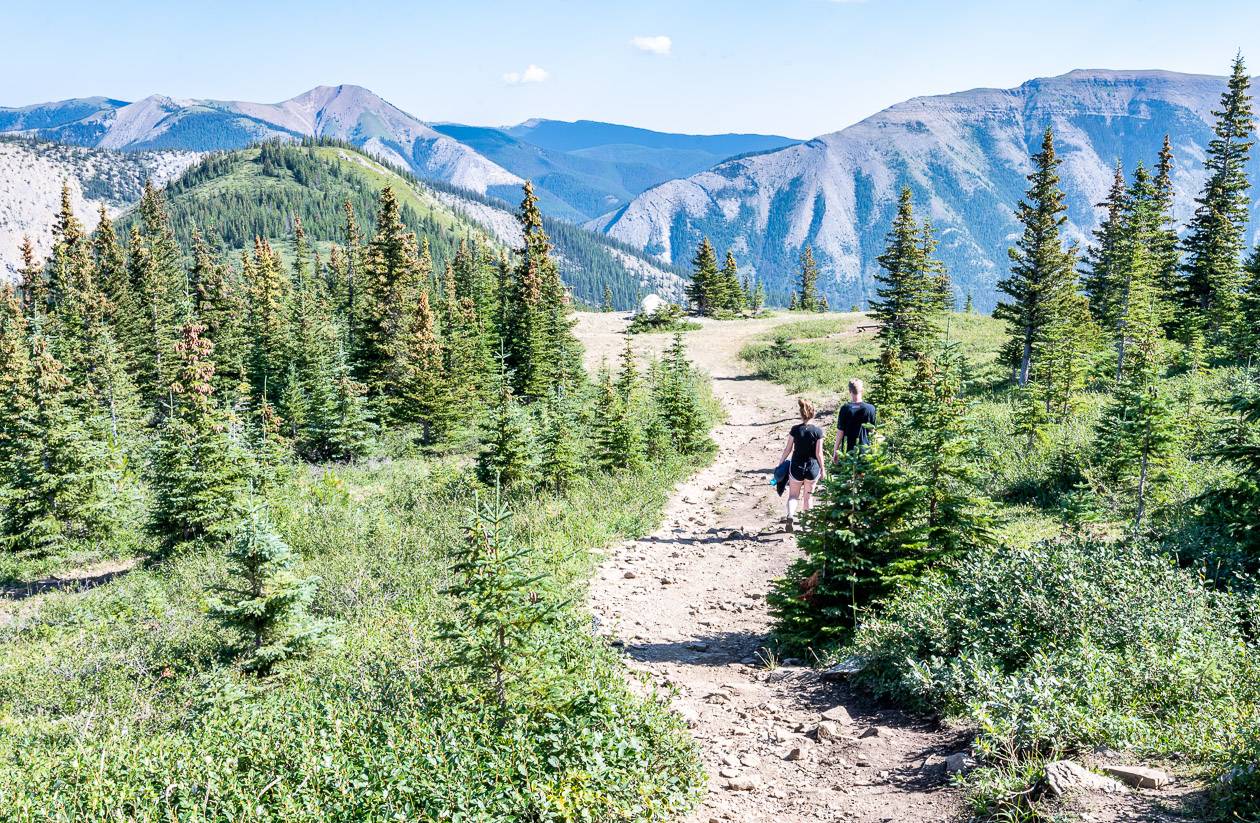
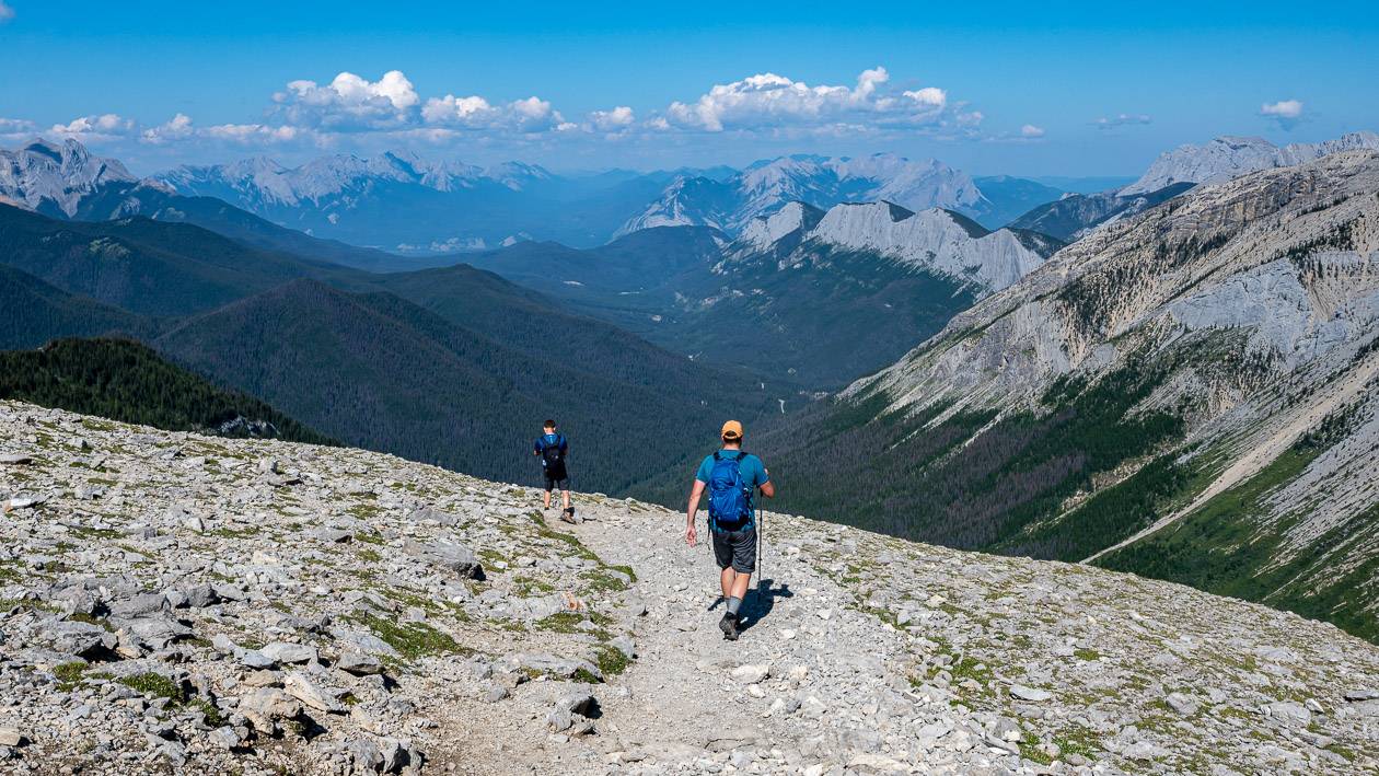
From the parking lot head up towards the hot springs pool building. The Sulphur Skyline trail heads off to the right of the pool building. You start on an easy paved path but that lasts for only a few hundred metres. Then it turns rocky, but it’s still wide. The trail steepens and the work begins.
You will pass several benches along the route. Take advantage of them, have a break, and catch your breath.
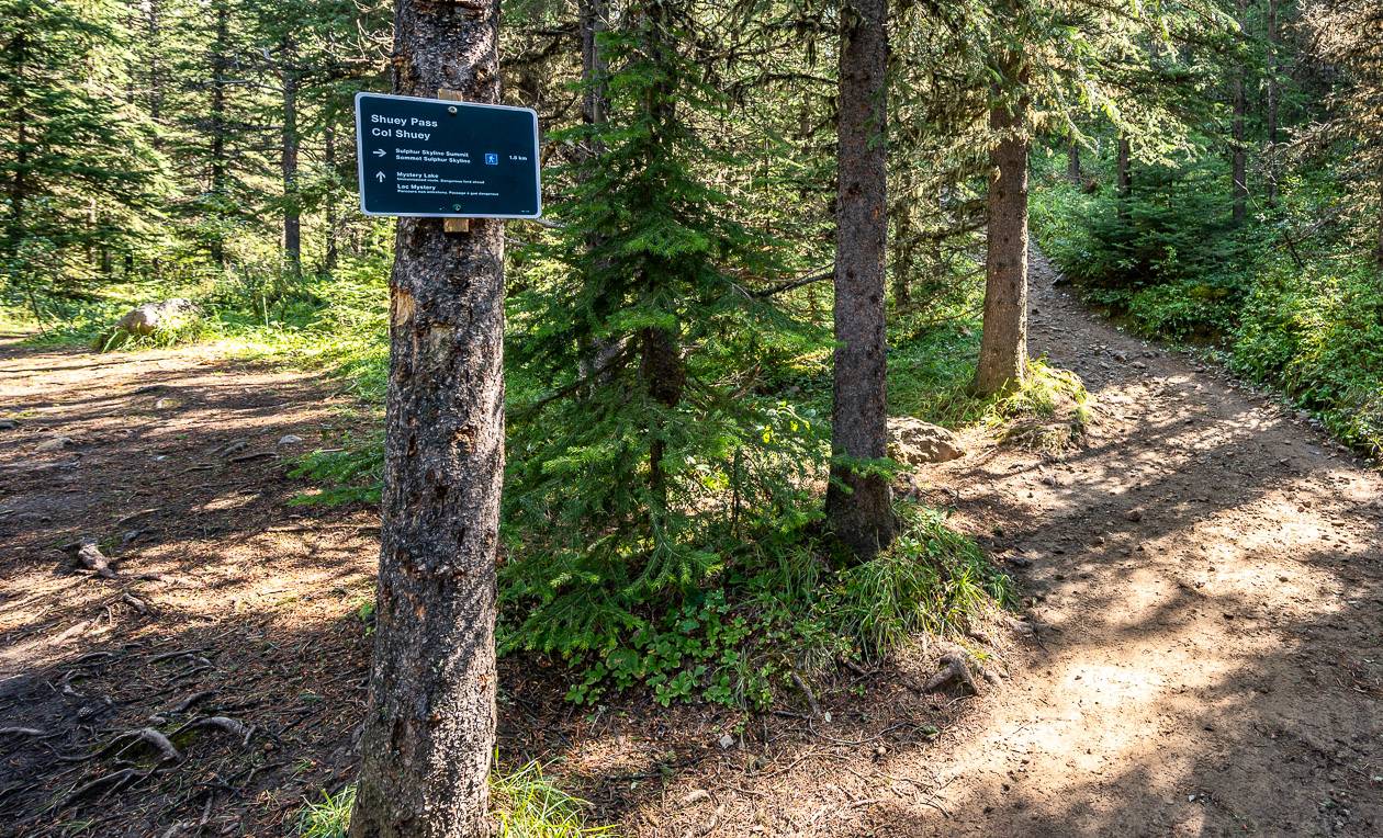
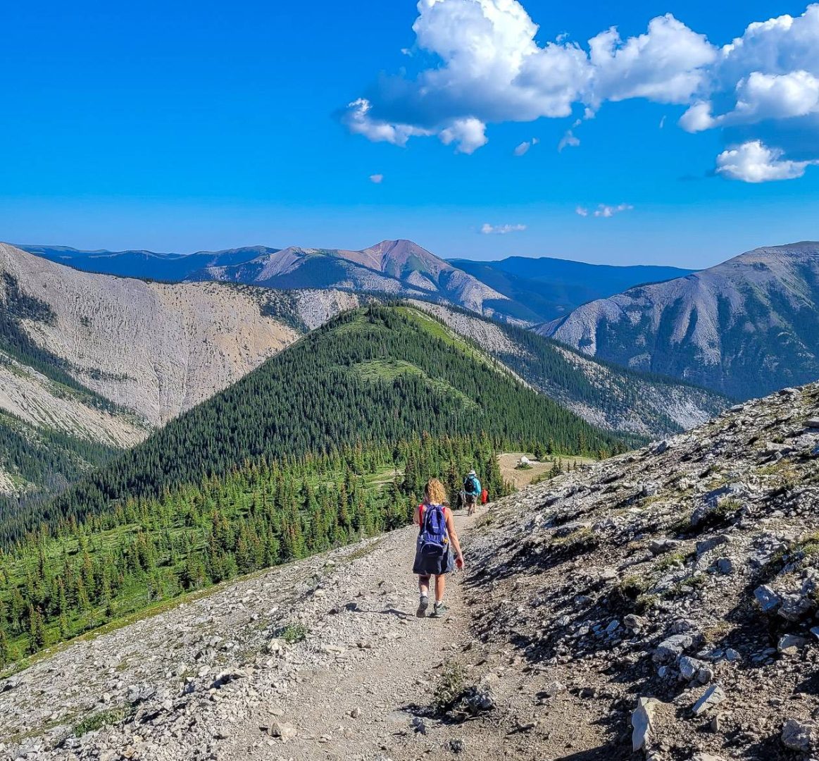
At the 2.2 km mark you reach a signed intersection at Shuey Pass. If you go left, you descend to the Fiddle River and eventually Mystery Lake. But you need to go right to continue the climb on the Sulphur Skyline trail. In short order, enjoy some views northeast, beyond the Yellowhead Highway.
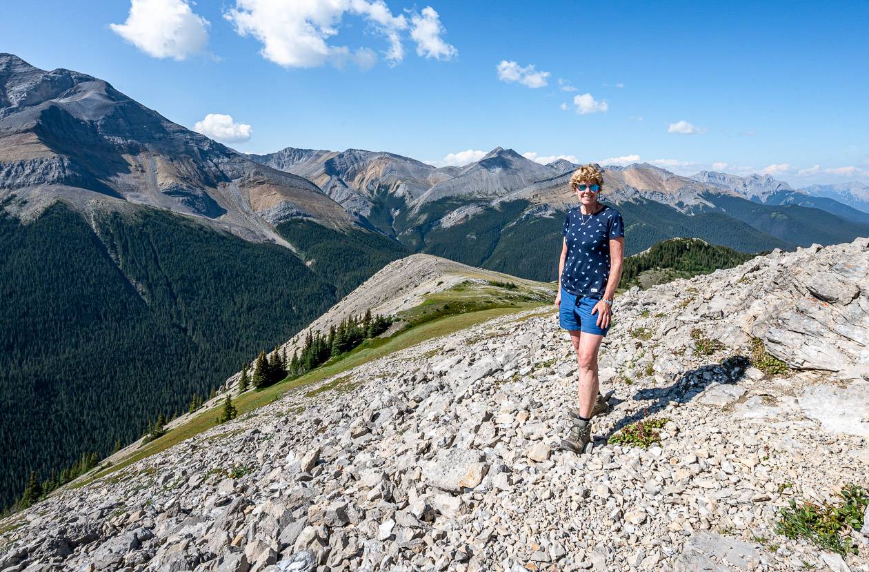
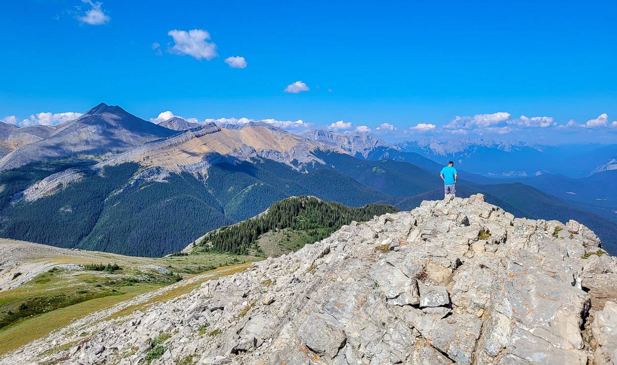
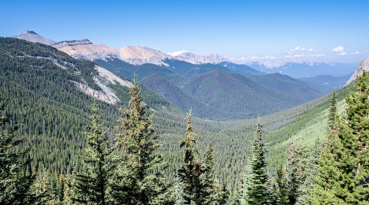
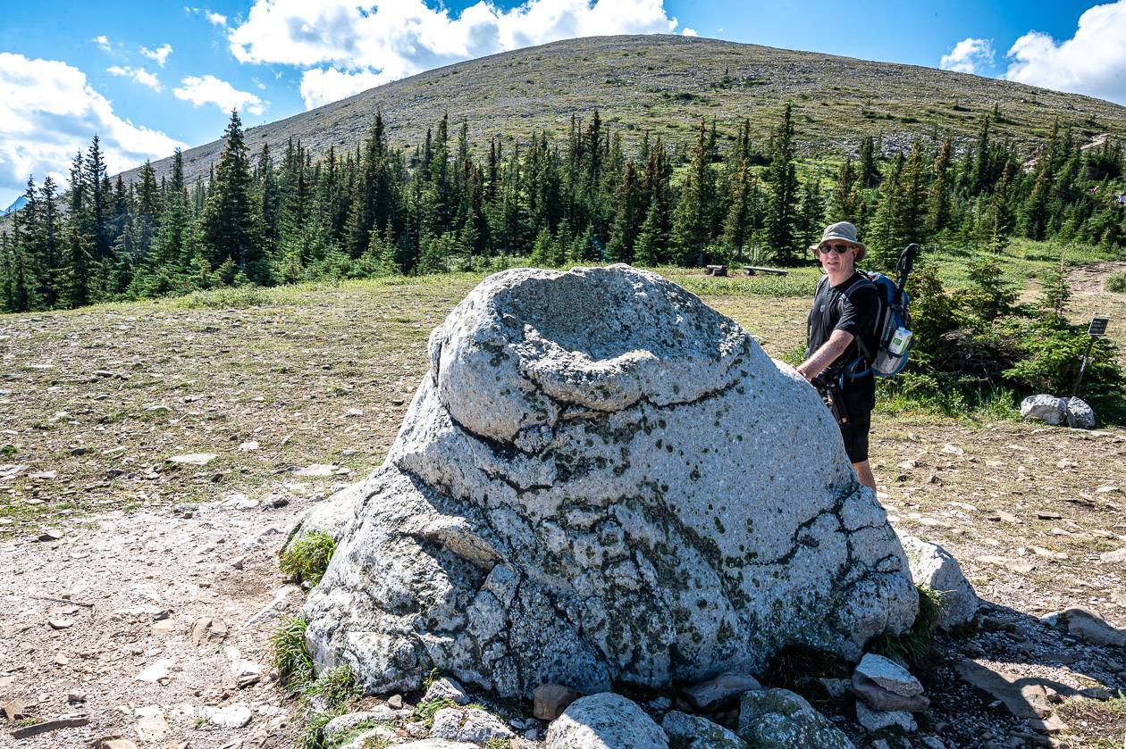
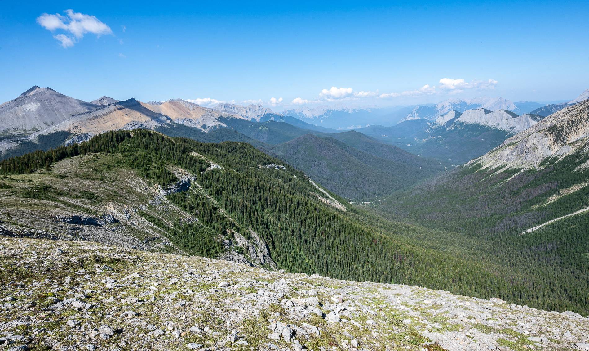
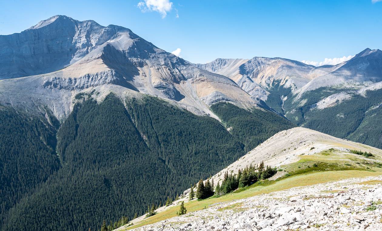
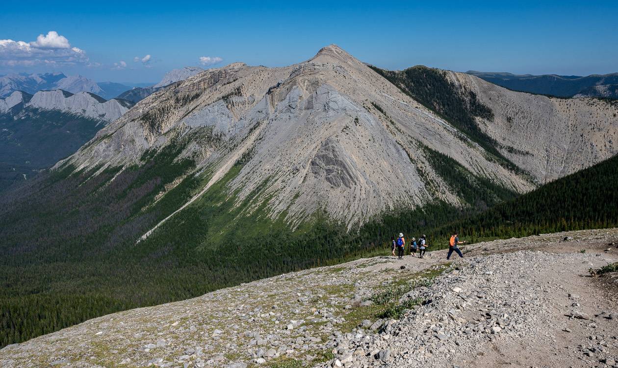
Keep climbing, and after another 20 minutes you’ll get a bit of a valley view to the southeast. And just 10 minutes later, you’ll arrive on a broad shoulder below the Sulphur Skyline summit. This is where you’ll see the large white boulder in a meadow – five photos down.
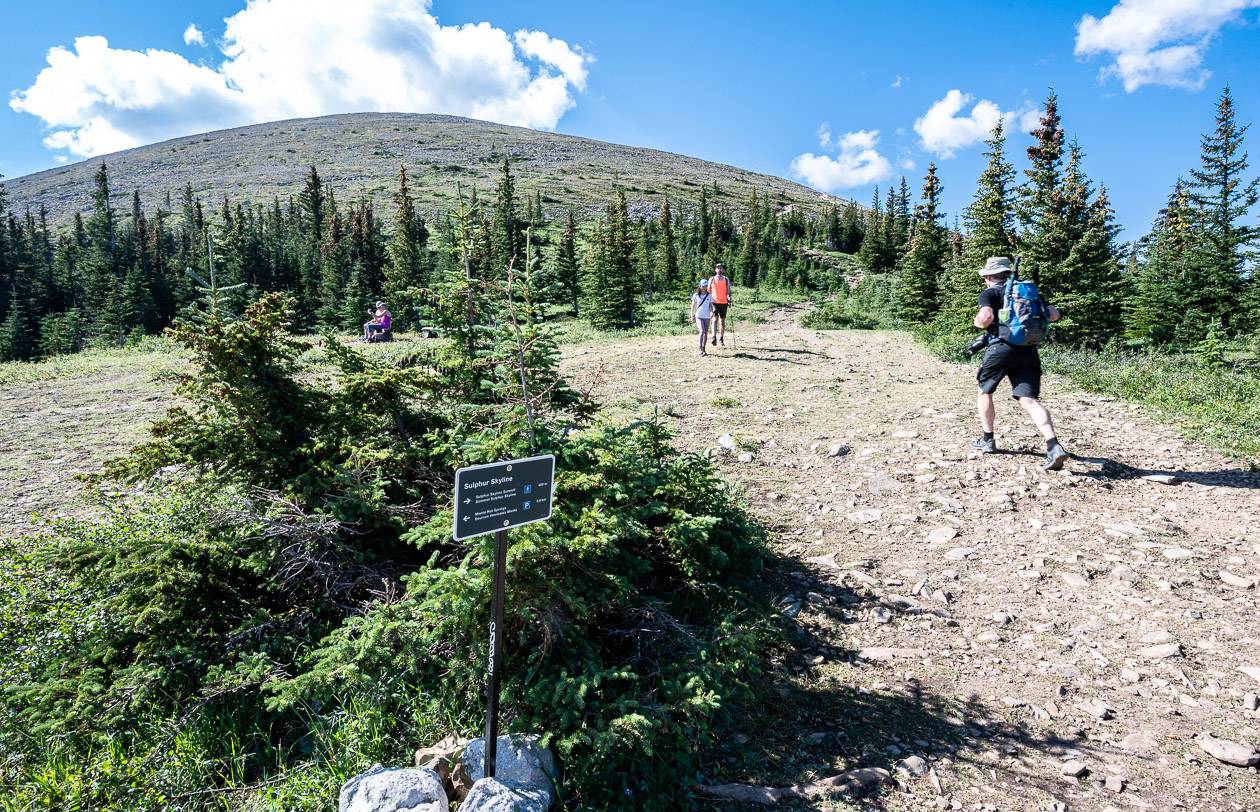
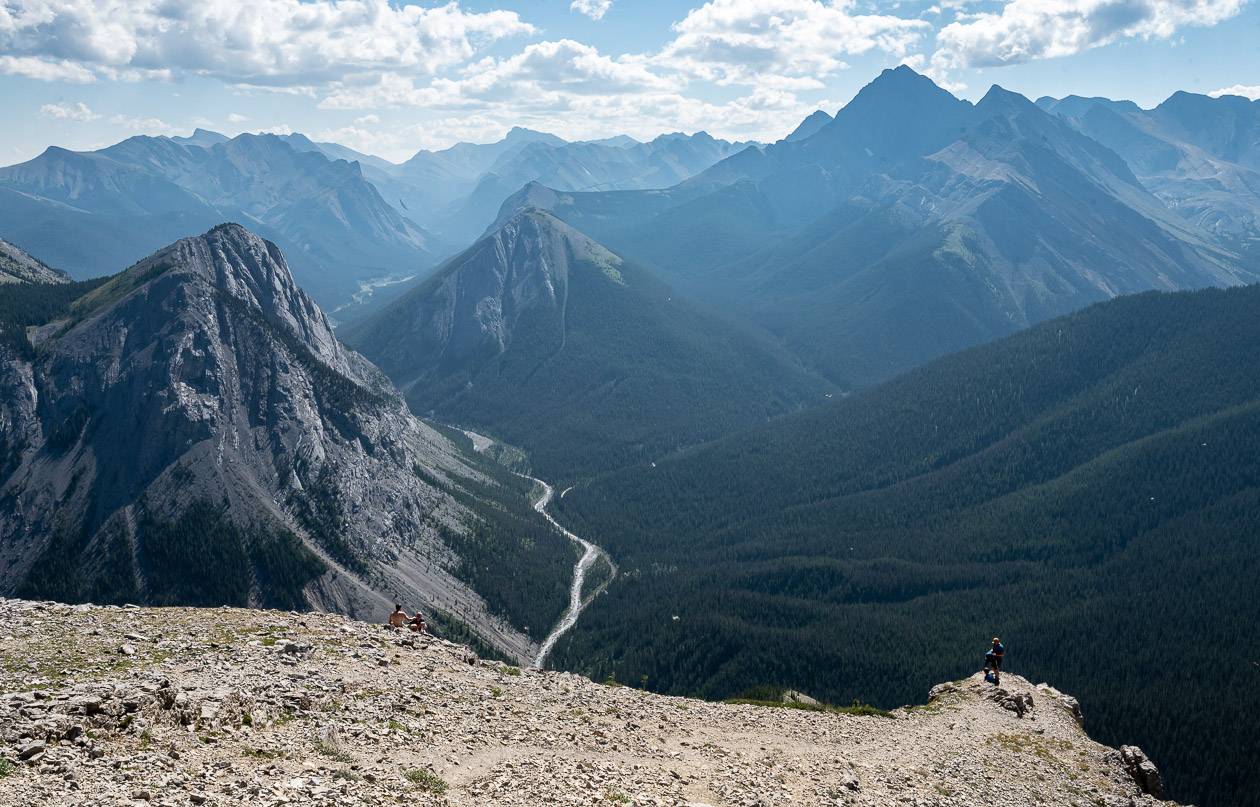
There’s one more bit of climbing on loose rock but at least you’re out of the trees so you can enjoy the beautiful view. After about 1.5 hours if you’re a speedy hiker, you should be standing on the large summit, enjoying the view.
To the southwest is in-your-face Utopia Mountain and Slide Mountain some distance away to the southeast. Mount Drinnan is off to the east. The Fiddle River Valley runs southeast. The Miette Range runs northwest and the Ashlar Range of steeply angled limestone with multiple summits is across from it.
At the top be prepared for wind. Find a big rock with a view and settle in for lunch before retracing your steps to the parking lot. Be hyper aware of the loose rocks on the first part of the descent. I don’t mind going up this rock, but I’m not a big fan of sliding out on the loose gravel -rock combo. Poles really help in this short section.
At the end of the hike, grab that bathing suit you remembered to bring and head for a lovely soak in the hot springs. I do believe you can rent bathing suits too.
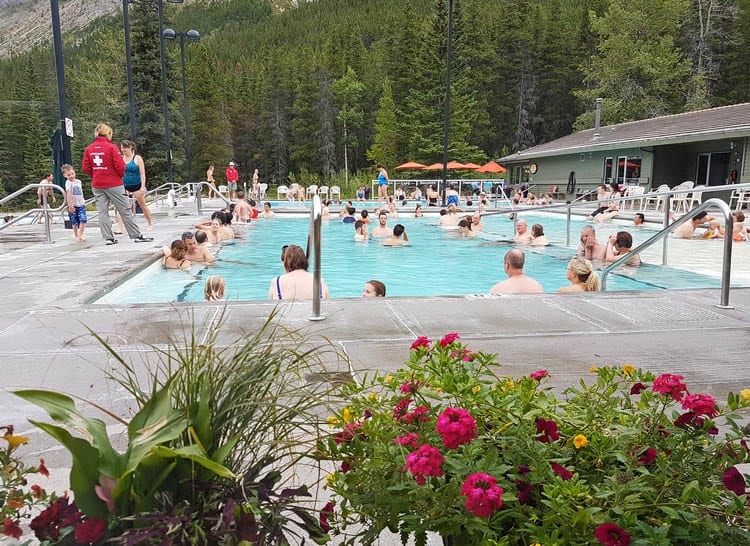
Soak in Miette Hot Springs
What better way to end the Sulphur Skyline trail hike than a soak in Miette Hot Springs – the hottest hot springs in the Canadian Rockies. The hot springs are kept between a temperature of 37°C (99°F) and 40°C (104°F), a good thing as they come down from the mountain at 54°C (129°F). After a strenuous hike, a soak is a great way to loosen the muscles and relax.
The hot springs are closed every year from mid-October to mid-May. When you drive the road to the hot springs, you’ll understand why it makes sense to close it.
The entrance for Miette Hot Springs is $7.75 for adults, and $6.75 for youth 3-17 and for seniors 65 and older.
What to take on the hike
If you’re heading to the mountains, you should always be prepared, even in the height of summer. A few things I’d recommend taking are a wind proof jacket and a fleece in case it’s cold on top. The Patagonia Down Sweater Jacket is ideal. (Men’s) (Womens)
If you like something comfortable to sit on at lunch time pack this almost weightless seat cushion (MEC) or on Amazon.
Hiking poles are a great idea, especially the collapsible ones, on this hike because it’s so steep. They’ll help save your knees.
I find a ball cap or a brim hat with a chin strap invaluable in the rain or on a hot, in your face sunny day.
Another nice addition for those of you who love wildflowers is the book Popular Wildflowers of Alberta and the Canadian Rockies.
Where to stay in Jasper National Park
The Miette Campground on Miette Road offers running water, fire rings, and flush toilets. It can be reserved.
One of the closest places to stay is the Miette Mountain Cabins at the intersection of Miette Road and the Yellowhead Highway.
Near the East Gate is the Overlander Mountain Lodge. They are known for their incredible wine list.
Just outside of the town of Jasper is the Pyramid Lake Resort, a great option if you want to be on a lake and near some biking and hiking trails.
In town check out the Crimson Hotel or if you want to splurge the Fairmont Jasper Park Lodge.
Click on the photo to bookmark to your Pinterest boards.